
 Hiking
We start the route from La Jonquera, following the track that takes us to Mas Brugat, a modernist farmhouse built on a rock.
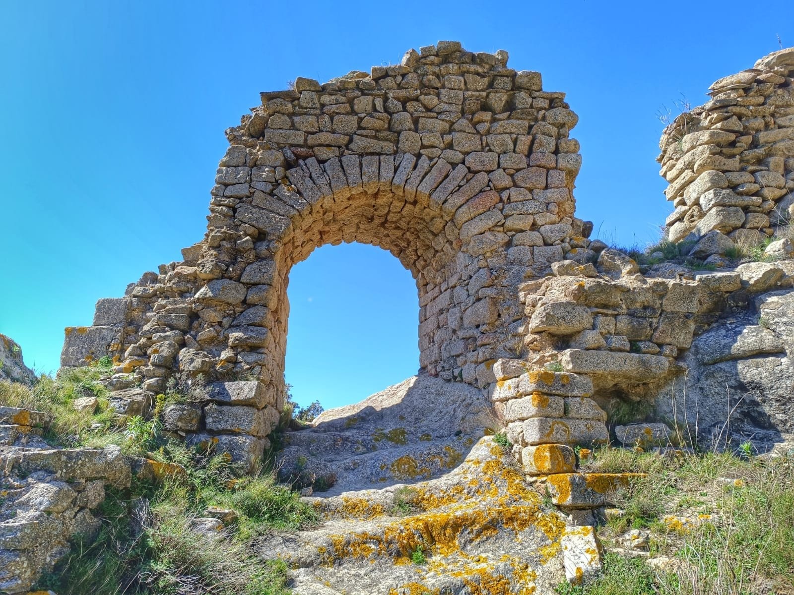
Unfortunately, near it, there is the quarry of the same name, a large 13-hectare operation that includes a 9,000-square-meter granite rock treatment plant, located just 500 meters from the PEIN de l'Albera. We continue until we reach the signposted turnoff to the Roc Lluent path, which guides us to the church of Sant Pere del Pla de l'Arca, located in the highest basin of the Llobregat d'Empordà. This church, with a single nave, had an apse with a horseshoe plan. The area around the church has suffered serious damage due to wind and forest fires, especially those that occurred in 1986 and 2012. Once there, we connect with the path that takes us to the scree of Salt del Fitó, which we will have to descend and then climb back up the same path to return to Sant Pere del Pla de l'Arca. Once we pass Sant Pere del Pla de l'Arca we head towards Coll dels Fangassos, and just after passing Font del Vesc, we follow the track that runs along the ridge of the Serra del Caze until we connect with the G.R. 11. We advance towards Santa Llúcia until we reach the point where we leave the GR to follow the yellow marks, which now lead us on a descent. We deviate a few meters to discover the remains of a wall built on the rock, known as the Esquerda de la Bastida, identified as a possible Visigoth castle. The descent becomes steeper until we reach the foot of Rocabertí Castle, located on the top of a large rocky promontory. We ascend to the top through a small gateway, where we can see the remains of several buildings. Everything indicates that this place could have been used as an impregnable fortress by a detachment of soldiers. The views from the top are impressive and offer excellent visual control of the territory. Then, we resume the descent in zigzags along a charming path that winds through the forest. When we reach Mas Brugat, we connect with a wide track that guides us to La Jonquera, where we conclude the route.
The legend:
The legend of the Cabra d’Or, says that the Rocabertí Castle and its military garrison had been besieged by the Saracens for days. Food in the castle was starting to run low. The besiegers had surrounded the castle at a certain distance, as a precautionary measure to avoid panic. It seems that, faced with the panorama of the siege, one of the besieged had an idea to confuse or deceive the enemy: when they only had one goat left, about to be sacrificed, they decided to fatten it and throw it over the cliff of Rocabertí. The goat must have ended up being disemboweled in the Saracen camp itself, who, upon seeing the luxury with which they allowed themselves to fatten the animals of the castle, understood that there must still be food for days inside the fort, therefore, a capacity for resistance that would last a long time. With this panorama, the best thing would be to abandon the siege and return home. To celebrate this event, the besieged decided to make a gold reproduction of the goat and bury it somewhere in the castle. Based on this legend, which like all must have a true part and a fanciful part, with more or less intensity we still hear it explained by the grandparents of La Jonquera who assure us that the goat is still there because no one has ever found it.
Published on 24 October 2026